![]()
|
Answer to Question 7 |
|
|
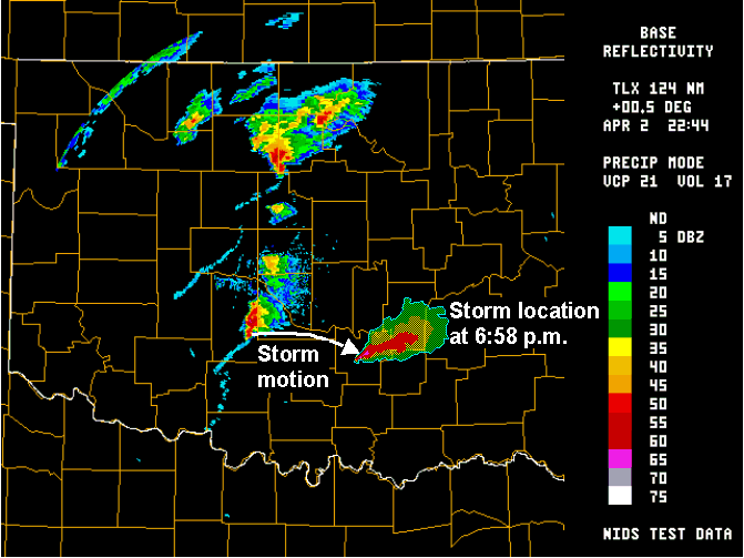
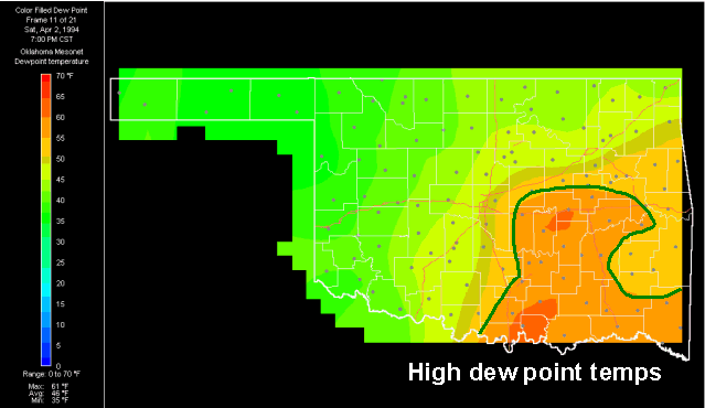
Question 7. Notice the motion of the thunderstorm that moves from Caddo and Grady counties to
Pontotoc and Coal counties between 4:30 and 8:30. Do any Mesonet data plots provide a
reason as to why that storm behaved as it did?
|
|
Answer. The right-moving thunderstorm propagated from Caddo and Grady counties begins to toward Pontotoc and Coal counties. The storm turned to enter an environment that has the most abundant moisture. Note the dew point maximum that extended from the Red River to Seminole and Okfuskee counties. The storm "wants" to access this rich moisture tongue. |
|
|