![]()
|
Answer to Question 1 |
|
|
Question 1. View the WSR-88D, visible and infrared satellite images that were available to you and to
the NWS during the period of 2200-2330 UTC (5:00-6:30 PM CDT). What meteorological
concerns might you have at this time? What specific actions should you be considering for the
population-at-risk in Tarrant and Dallas counties? |
|
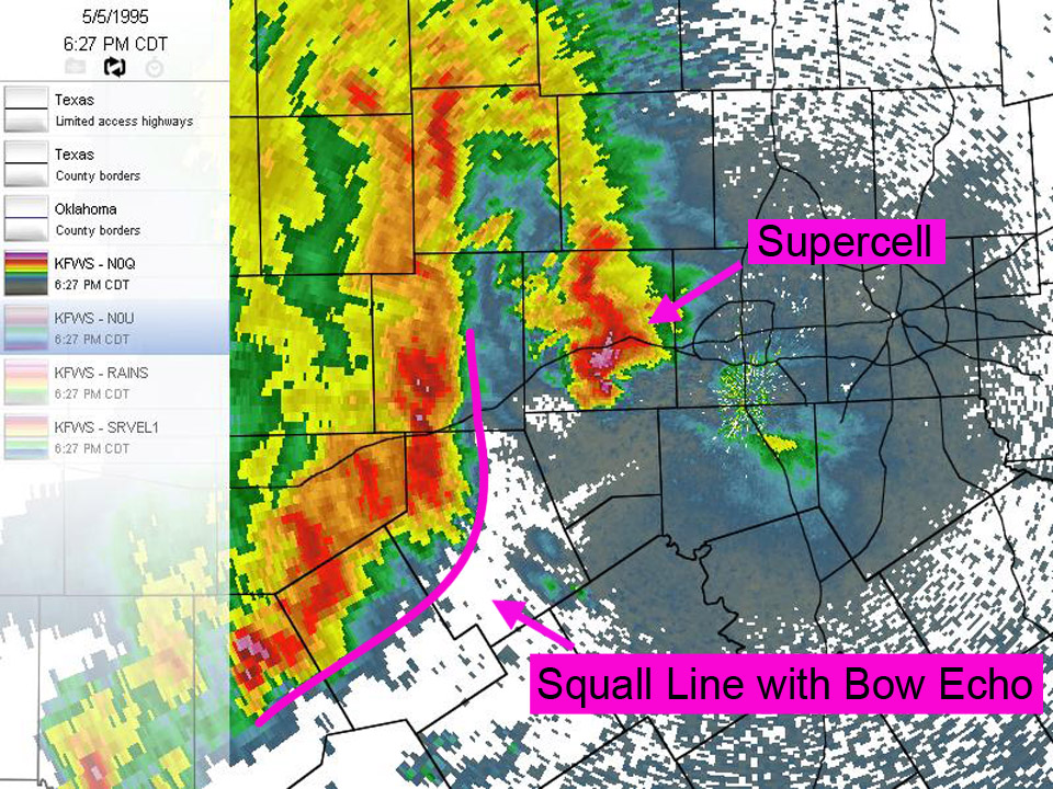
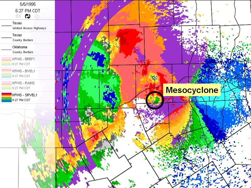
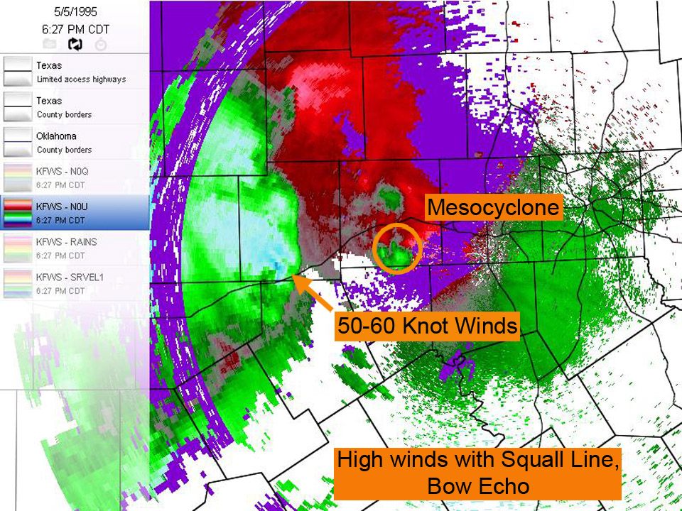
Answer. The base reflectivity image from 6:27 p.m. indicates a supercell thunderstorm followed by a heavy squall line approaching the Dallas/Ft. Worth area. This squall line may produce heavy rain and gusty straight line winds. The base velocity image from the same time reveals a mesocyclone within the supercell. This supercell thunderstorm may produce large hail and possibly a tornado. |
|
|