![]()
Answer to Question 5 |
|
Question 5. Move to the period of 0000-0100 UTC (7:00-8:00 PM CDT) and view the latest images. What meteorological concerns do you have now? What specific population is at risk? What actions are you considering? |
|
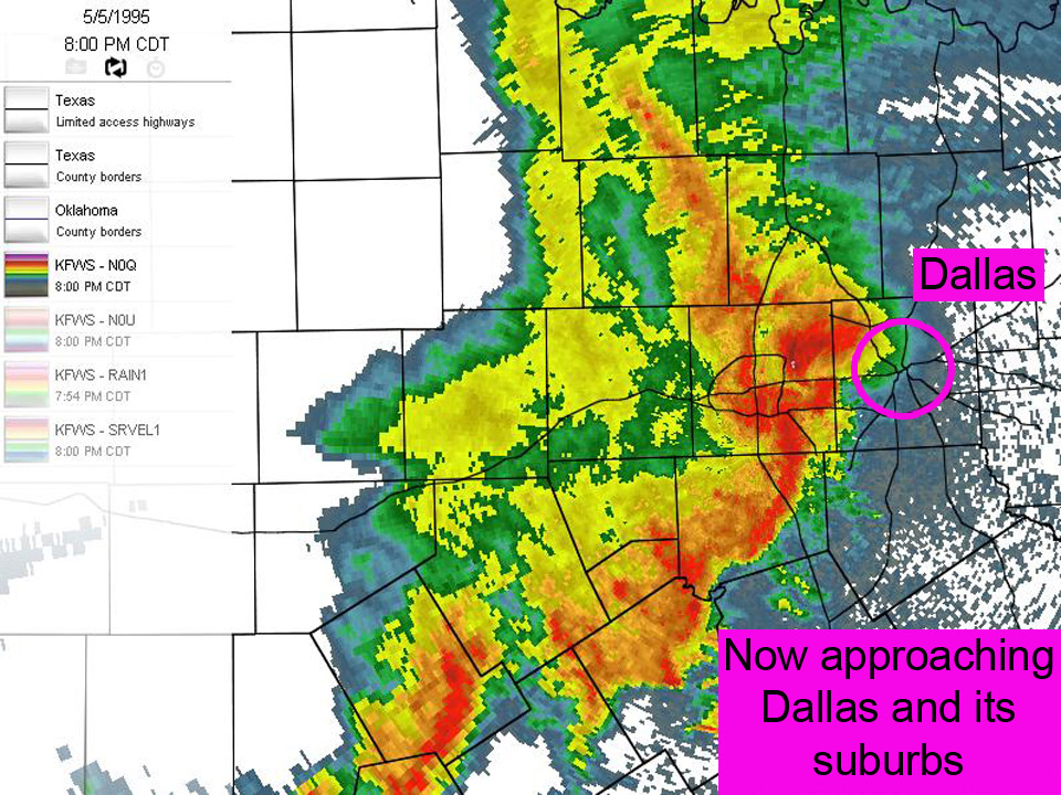
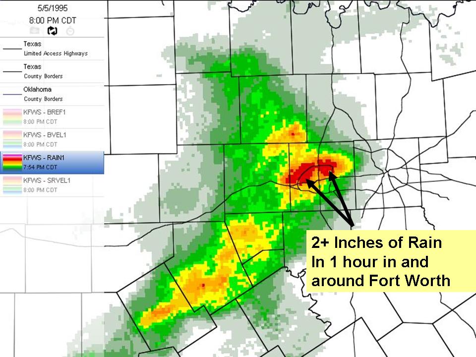
Answer. At 8 p.m. the supercell storm has become part of the squall line. The threat of large hail and tornadoes has diminished, but the threat of heavy rains and flash flooding remains, due to the slow-moving nature of the supercell. The one-hour precipitation image indicates 2+ inches of rain has fallen. At this point, flash flooding in the Dallas Metro area may become a problem due to the impermeable surfaces in the urban areas. |
|
|