![]()
Answer to Question 3 |
|
|||||
| |||||
|
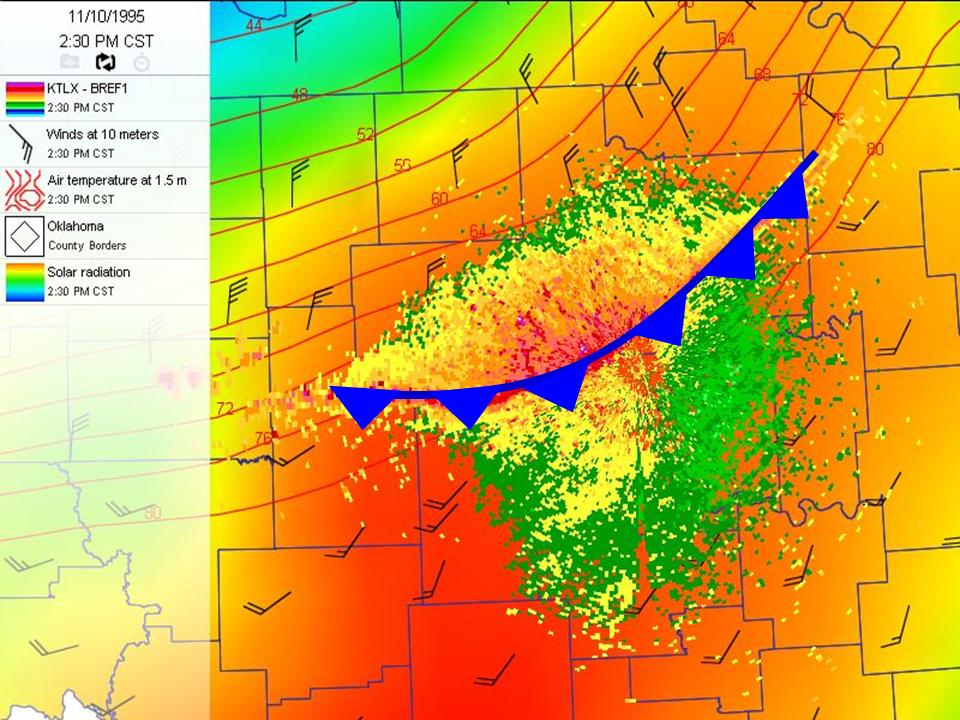
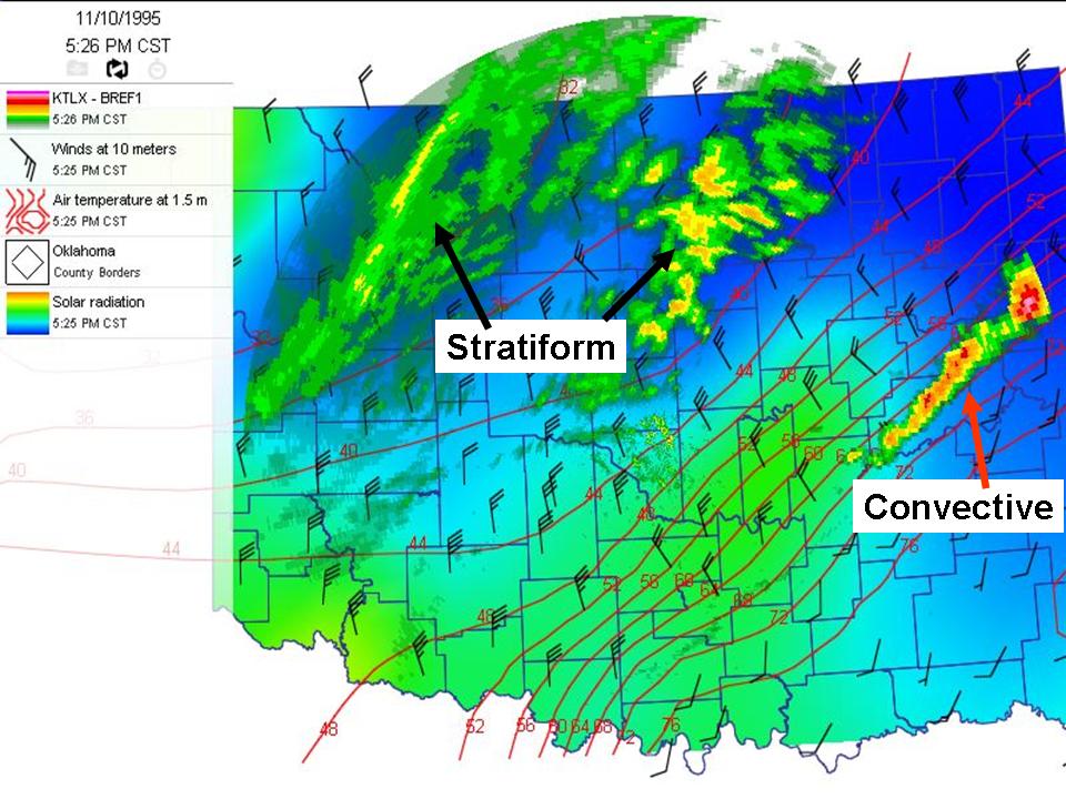
Question 3. Look at the radar base reflectivity images between 2:30 and 5:30 p.m. Locate the cold front and
then classify the echoes as convective, stratiform, and non-precipitating. |
|
Answer. The 5:26 p.m. radar image shows stratiform precipitation over a large part of northwest and north-central Oklahoma behind the front. There are a few convective cells east of Tulsa that form on the front. The 2:30 radar shows the cold front and once looped through, the front (non-precipitating echoes) stretches across central and south-central Oklahoma moving to the southeast. |
|
|