![]()
Answer to Question 6
|
|
|
|
|
|
|
|
||||
|
Answer to Question 6 |
|
|||
|
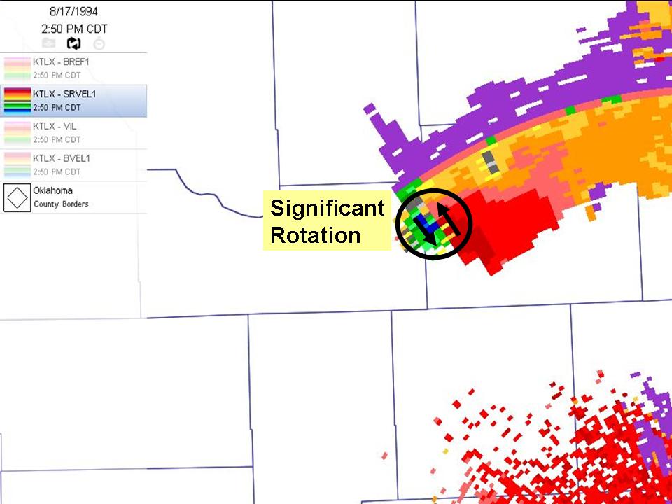
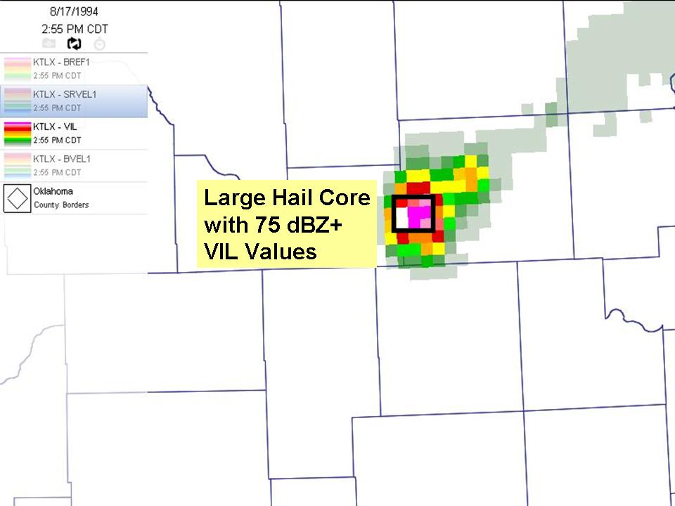
Question 6. Look over the radar data products between 2:30 and 3:30 p.m. over western Oklahoma. Note the magnitude of the reflectivity and VIL values.
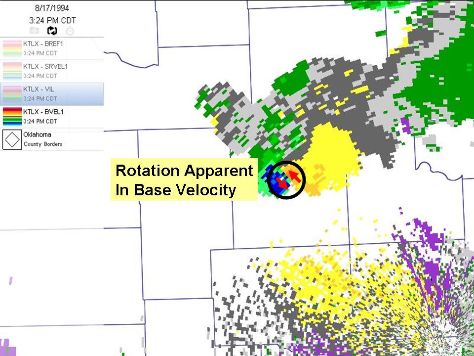
In addition, examine the base velocity and storm relative velocity images to find areas within the storm that would concern an emergency manager
|


|
Answer. The 2:5 p.m. storm-relative velocity image showed an 80+ knot rotation on Tilt 1 over western Garfield county. VIL values increased from 65 to 74 kg/m2 between 2:30 p.m. and 3:30 p.m. The rotation is so strong it even shows up quite vividly on Base Velocity. Emergency managers in the path of this storm should prepare for large hail, severe winds, and a tornado threat. |
![]()
OK-FIRST
Project, Oklahoma
Climatological Survey, 100 East
Boyd, Suite 1210, Norman, OK 73019
Copyright © 1996-2005 Oklahoma Climatological Survey. All
Rights Reserved.
Send comments or questions concerning OK-FIRST to
okfirst@mesonet.org