![]()
|
Answer to Question 1 |
|
|
|
|
|
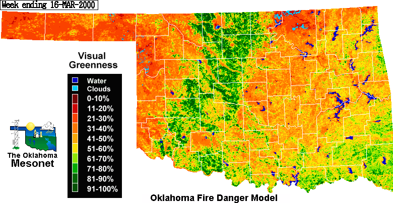
Question 1. Before the model can apply weather data, it must first "set the table" with the current
vegetation status across Oklahoma. Check out the most recent visual and relative greenness
values near the bottom of the OKFD output page. Where is it greenest? Now look at the
relative and visual greenness images from March 16, 2000. On these images, there is a definite
band of greenness which runs from west of Lawton to Enid to west of Ponca City. Based on
what you know of Oklahoma in mid-March, what is causing this band?
|
|
Answer. The band of greenness from Lawton to Enid is caused by the green winter wheat crop that has emerged and started to grow. The northwest to southeast striations are the Canadian River valleys. The light blue areas in Osage county are areas that were obscured by clouds each time the satellite passed over the area during the week this image was produced. |
![]()
OK-FIRST
Project, Oklahoma
Climatological Survey, 100 East
Boyd, Suite 1210, Norman, OK 73019
Copyright © 1996-2005 Oklahoma Climatological Survey. All Rights Reserved.
Send comments or questions concerning OK-FIRST to
okfirst@mesonet.org