![]()
|
Answer to Question 16 |
|
|
|
|
|
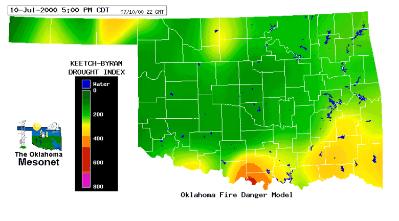
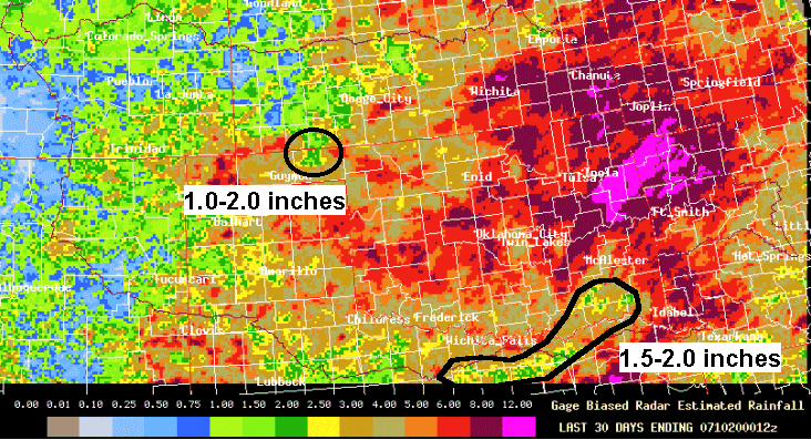
Question 16. Examine the latest Keetch-Byram Drought Index (KBDI) values for the state. Which
portions of the state show drought condition tendencies? Compare the KDBI map to the
ABRFC 30-day precipitation totals. Do the maps generally agree?
|
|
Answer. The areas around the red river in south Oklahoma and Beaver county in the panhandle are the areas in the state that received the least rainfall over the 30-day period. The ABRFC 30-day precipitation total map shows that this area has received the least rain in the state. These maps do generally agree. Because the KBDI values are greatest in Love county near the Red River, the drought conditions are the most severe in that area. |
![]()
OK-FIRST
Project, Oklahoma
Climatological Survey, 100 East
Boyd, Suite 1210, Norman, OK 73019
Copyright © 1996-2005 Oklahoma Climatological Survey. All
Rights Reserved.
Send comments or questions concerning OK-FIRST to
okfirst@mesonet.org