![]()
|
Answer to Question 2 |
|
|
|
|
|
|
|
Question 2. View the output from the most recent run (probably the 2 pm run) of the OKFD model and
the latest Mesonet data. (Use the plug-in or the fire-weather map) At which locations in the
state is a fire the most likely to ignite?
|
|
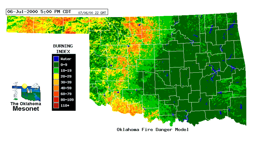
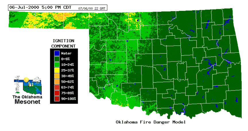
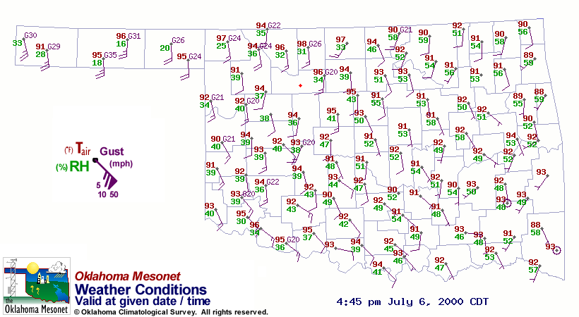
Answer. At the time of these images (July 6, 2000 at 5:00 p.m.), the panhandle had the highest IC values suggesting that a fire would be more likely to ignite there. One reason for this is the dry air (temperatures in the mid to upper 90's and dew points in the teens). The panhandle and the wheat belt area have the highest BI values, suggesting that flame lengths would be higher there. Flame lengths in those areas would probably be 8-10 feet. Note the warmer air temperatures in the wheat belt area. In July, the wheat has been harvested, leaving dry, brown stubble, which causes less evapotranspiration than surrounding greener areas. Less evapotranspiration implies less humid air which increases sensible heat (which can be measured by temperature sensors) versus less latent heat (which is involved with evaporation of water). |
![]()
OK-FIRST
Project, Oklahoma
Climatological Survey, 100 East
Boyd, Suite 1210, Norman, OK 73019
Copyright © 1996-2005 Oklahoma Climatological Survey. All
Rights Reserved.
Send comments or questions concerning OK-FIRST to
okfirst@mesonet.org