![]()
|
of August 13-15, 2005 Answer to Question 5 |
|
5. Examine the following 8-hour loop, valid from 10:00 pm on the 13th to 6:00 am on the 14th. BREF1 from Norman is shown, plus winds and temperatures from the Oklahoma Mesonet.
- Where is the main initiation focus for storms?
- In what general direction do they propagate?
- Is this consistent with your expectations?
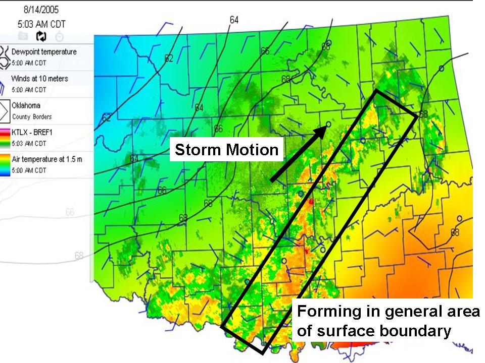
Answer.
- The storms are firing along and to the north of the surface boundary
- This goes well with the WFO forecast discussion from Question 2. The forecaster was confident that storms would fire along and to the north of the surface boundary, even though the exact position of the surface boundary was in doubt.
- The storms are generally progating to the northeast, along the stationary surface front.
- The northeastward track of the storms is in agreement with the 500-mb flow
The Bottom Line:
- The forecaster was fairly confident that storms would fire along the surface boundary, but was unsure of its location.
- Using OK-FIRST data to track the surface features can help you deal with that forecast uncertainty!