![]()
|
of August 13-15, 2005 Answer to Question 9 |
|
9. Examine the following 4-hour loop, valid from 7:00 pm to 11:00 pm on the 14th. BREF1 from Norman is shown, plus winds and temperatures from the Oklahoma Mesonet.
- Where is the main initiation focus for storms?
- In what general direction do they propagate?
- Is this consistent with your expectations?
- Where do flooding hazards appear most significant?
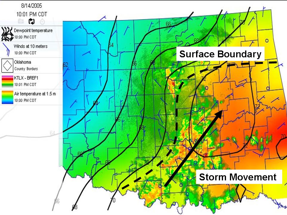
Answer.
- Storms continue to fire along and very near the front, and propagate slowly to the northeast. This is in line with information from the surface data and the upper-level data.
- The storms are showing several characteristics that suggest fooding concerns:
- They are producing significant precipitation. Most of the cells show reflectivities at or above 50 dBZ.
- Many of the cells are "training", that is, following one another much like the cars on a train. Locations beneath this "Rain Train" will get several episodes of heavy rain, one after another.
- The heaviest rainfall is traveling over areas that received 2-4 inches of rainfall in the previous two days
The Bottom Line.
-
During the course of this loop, the Norman WFO issued flash-flood warnings for Carter, Jefferson, Stephens, Pottawatomie, Seminole, Pontotoc, Garvin and Murray counties.