![]()
|
of January 3-5, 2005 Answer to Question 12 |
|
12. Examine a movie from 6:00 pm Tuesday through 2:00 am Wednesday, with BREF1 from Vance AFB (KVNX) and BREF1 from Norman (KTLX) (hint: toggle the radars in the legend to see individual features). Mesonet air temperatures and Mesonet wind observations are included.
- What precip type is suggested by the radar echoes?
- Where is the freezing line, in relation to the precip observed by the each radar?
- Does the freezing line begin to move during this 8-hour movie?
- What do you notice about the placement and motion of the heaviest precipitation elements? What threats do you think are present in northwest and west-central Oklahoma? What about on the warm side (south and east) of the freezing line?

Answer.
- Both radars still show reflectivity patters associated with liquid precipitation.
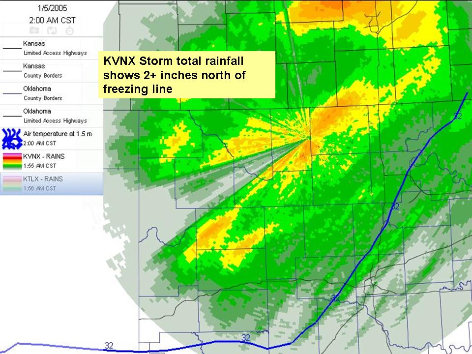
- The Vance radar shows the heaviest precipitation ocurring to the north and west of the freezing line for several hours.
- Radar-estimated accumulations of up to three inches suggest the potential for significant icing, especially on elevated surfaces.
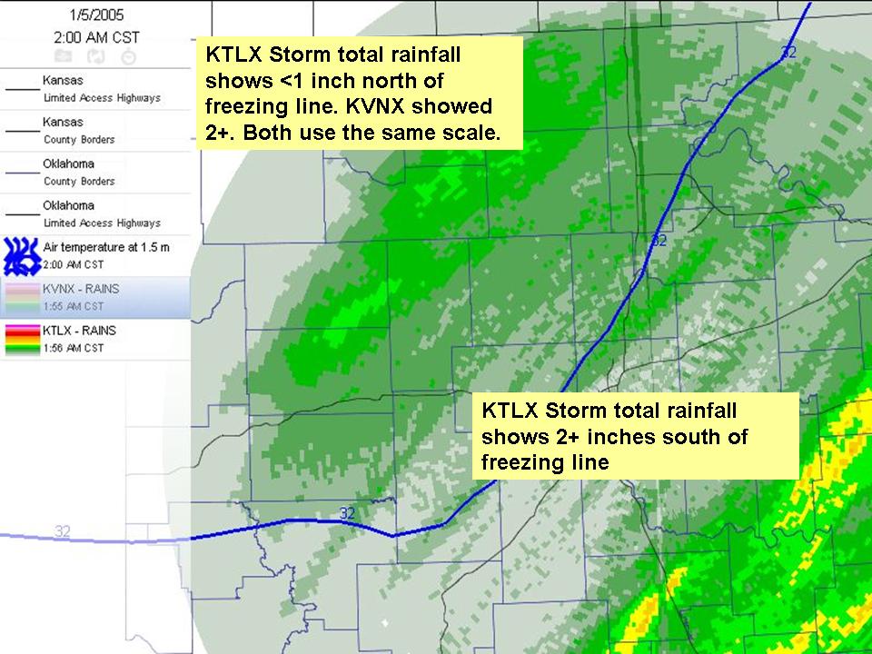
- The Norman radar's estimate of 2+ inches southeast of the radar may raise flooding concerns
- By the end of the movie, the freezing line is advancing southeastward.
The Bottom Line.
-
A combination of radar, surface, upper-air and model data - and don't forget the advice and products from the National Weather Service - can help you sort out the complexities of winter precipitation.
OK-FIRST Project, Oklahoma Climatological Survey, 100 East Boyd, Suite 1210, Norman, OK 73019
Copyright © 1996-2005 Oklahoma Climatological Survey. All Rights Reserved.
Send comments or questions concerning OK-FIRST to okfirst@mesonet.org.