Bounded Weak Echo Region
Bow Echo
Cold Front
Day 1 Convective Outlook from the Storm Prediction Center
Day 1 Probabilistic Outlook for Tornadoes from the Storm Prediction Center
Day 1 Probabilistic Outlook for Large Hail from the Storm Prediction Center
Day 1 Probabilistic Outlook for Severe Winds from the Storm Prediction Center
Comparison of Day 1 Probabilistic and Categorical Outlooks from the Storm Prediction Center
Day 2 Convective Outlook from the Storm Prediction Center
Day 2 Probabilistic Outlook from the Storm Prediction Center
Dry Line as Radar Thin Line
Dry Line & Cold Front in Dew Point
Dry Line & Cold Front Intersection
Equivalent Potential Temperature
Hail and Composite Reflectivity
Hail and Vertically Integrated Liquid
Hail Scatter Spike
Hook Echo
Mesocyclone in Base Velocity
Mesocyclone in Storm-Relative Velocity
Mesocyclone Algorithm
Outflow Boundaries
Propagation of Radar Beam
Thunderstorm Initiation
Tornado Detection Algorithm
Flooding
Winter Weather
Fire Weather
Heat & Drought
General Radar Interpretation
OK-FIRST Project, Oklahoma Climatological Survey, 100 East Boyd Street, Suite 1210, Norman, OK 73019. Copyright © 1996-2004 Oklahoma Climatological Survey. All Rights Reserved. Send comments or questions concerning OK-FIRST to okfirst@mesonet.org
 Bounded Weak Echo Region
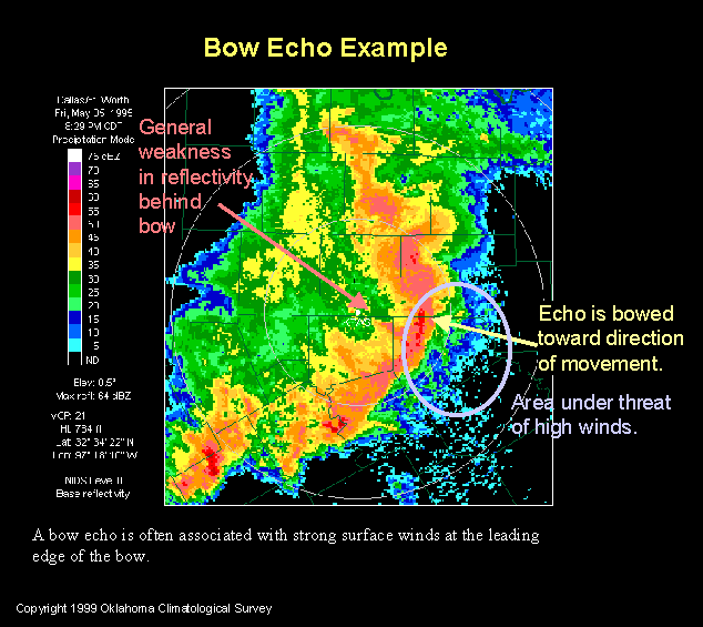 Bow Echo
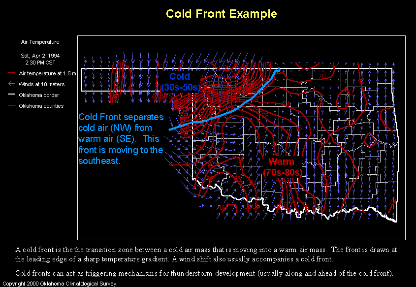 Cold Front
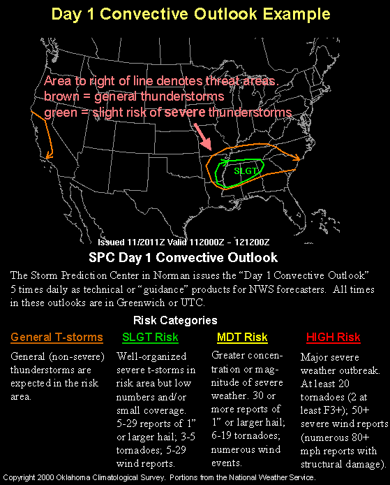 Day 1 Convective Outlook
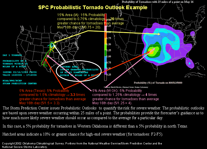 Day 1 Probabilistic Outlook for Tornadoes
 Day 1 Probabilistic Outlook for Large Hail
 Day 1 Probabilistic Outlook for Severe Winds
 Comparison of Day 1 Probabilistic and Categorical Outlooks
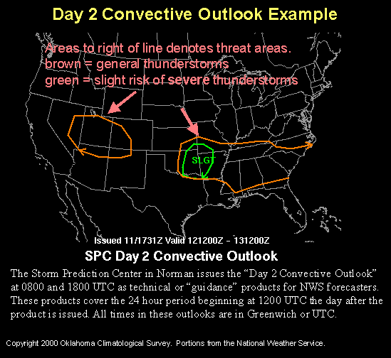 Day 2 Convective Outlook
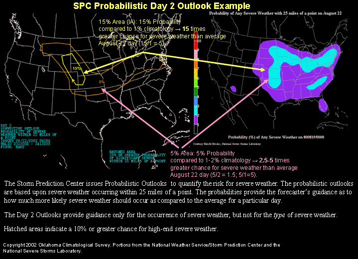 Day 2 Probabilistic Outlook
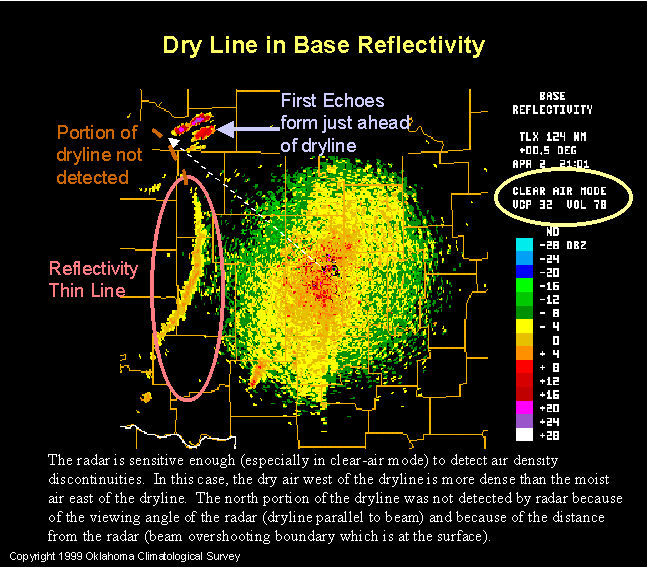 Dry Line as Radar Thin Line
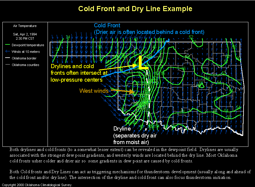 Dry Line & Cold Front in Dew Point
  Dry Line & Cold Front Intersection
  Equivalent Potential Temperature
  Hail and Composite Reflectivity
 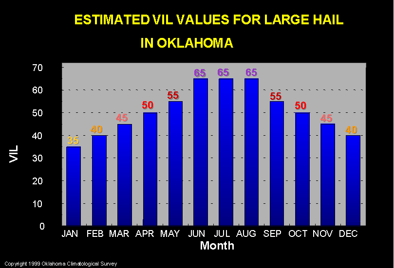 Hail and Vertically Integrated Liquid
 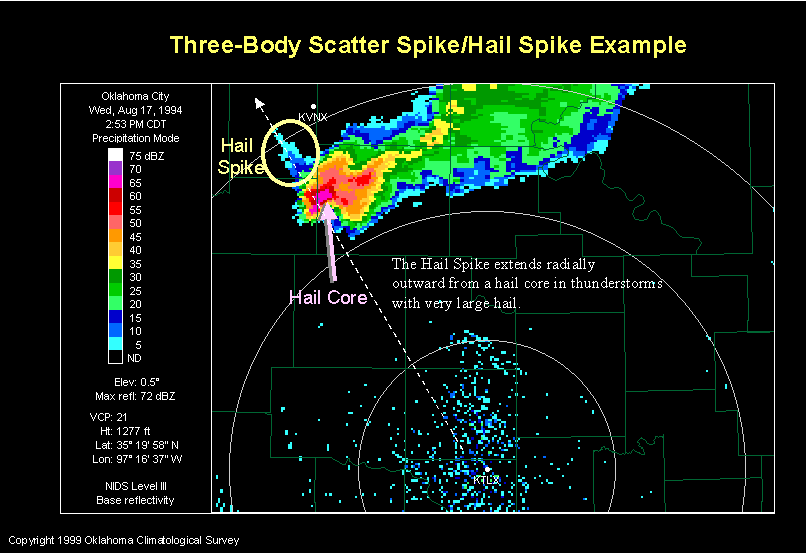 Hail Scatter Spike
 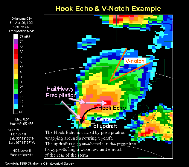 Hook Echo
 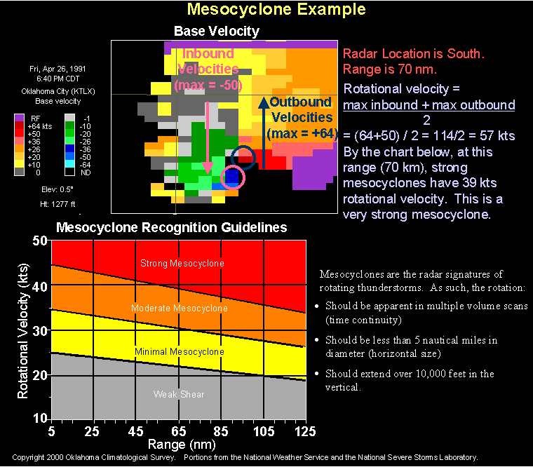 Mesocyclone in Base Velocity
 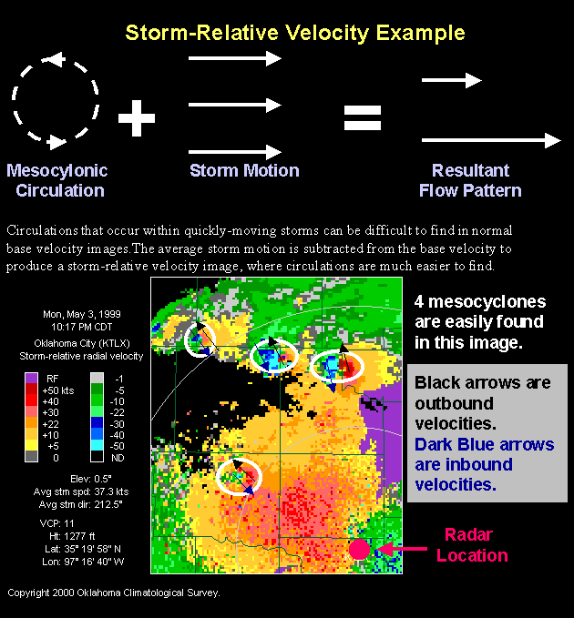 Mesocyclone in Storm-Relative Velocity
 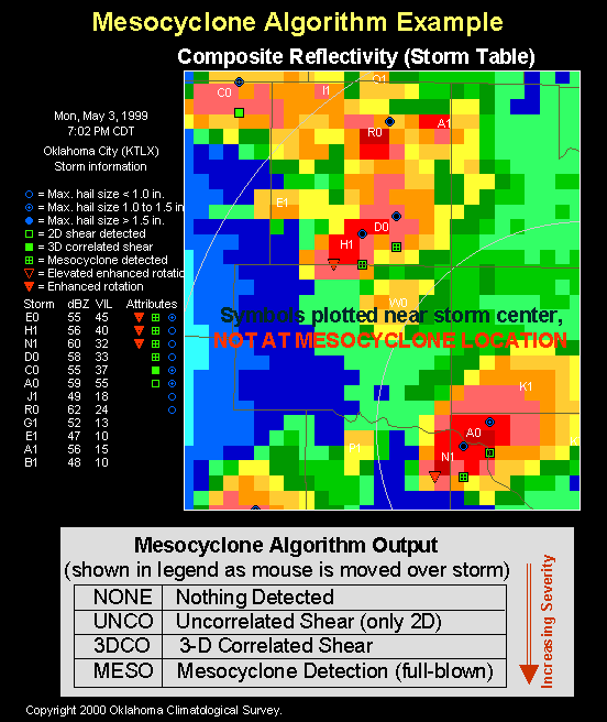 Mesocyclone Algorithm
 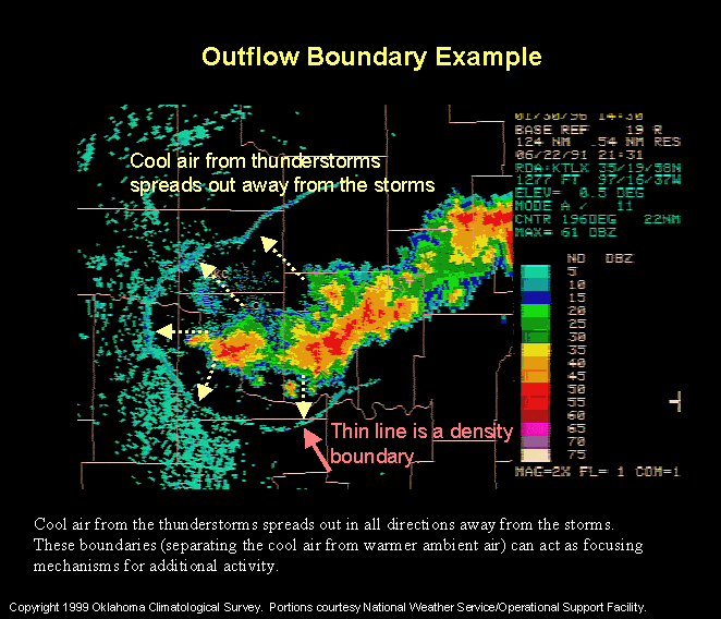 Outflow Boundaries
  Propagation of Radar Beam
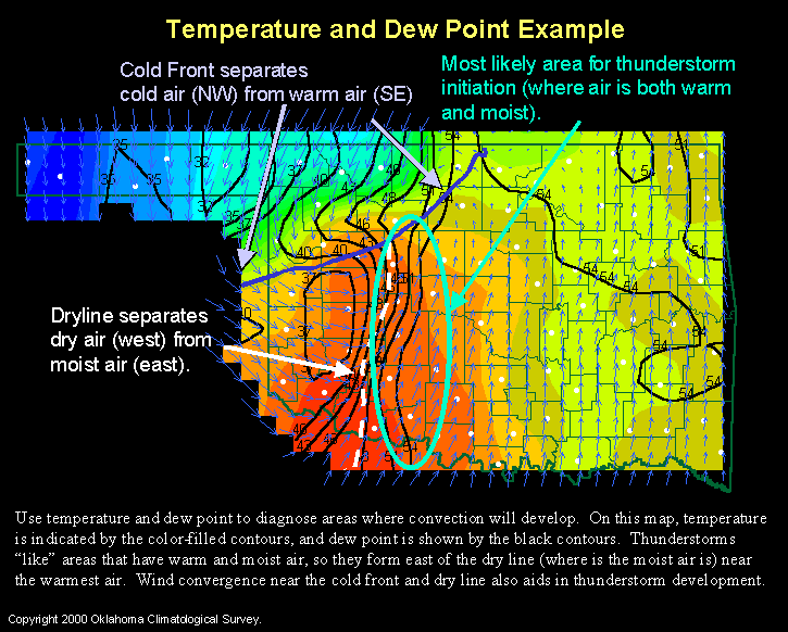 Thunderstorm Initiation
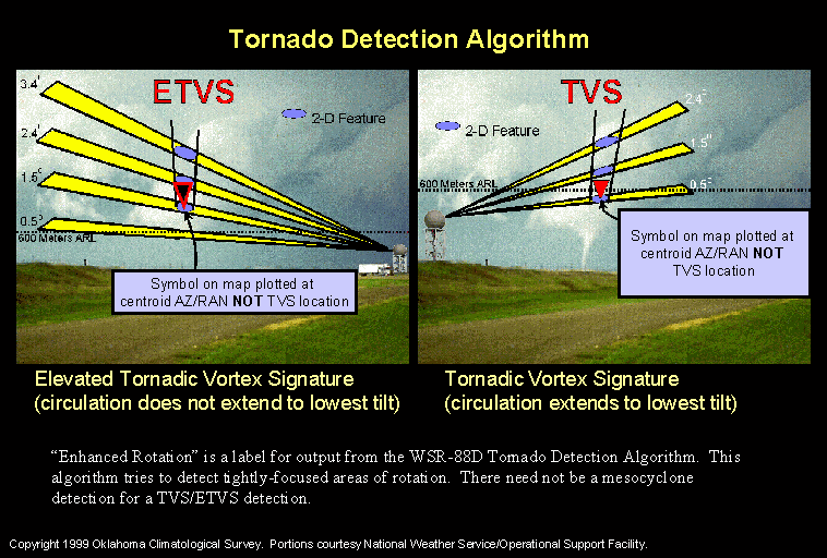 Tornado Detection Algorithm