Oklahoma Climatological Survey


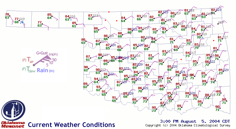
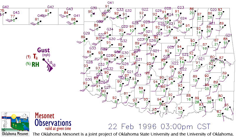
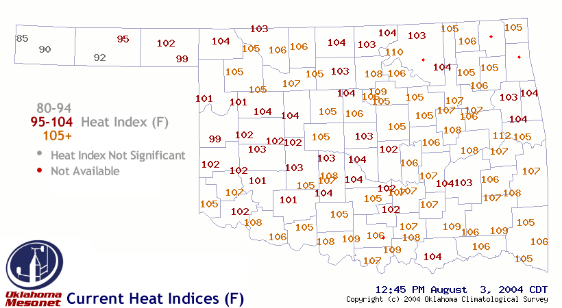
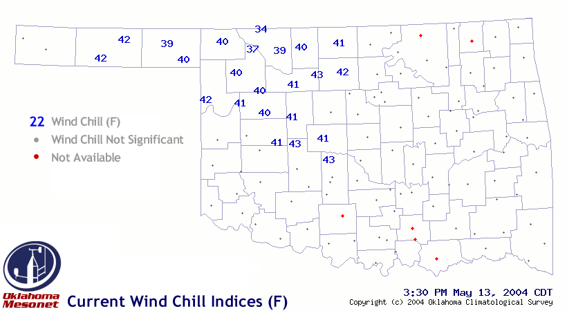
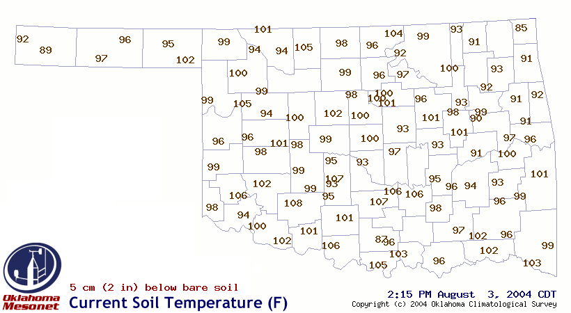
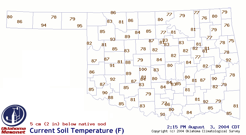
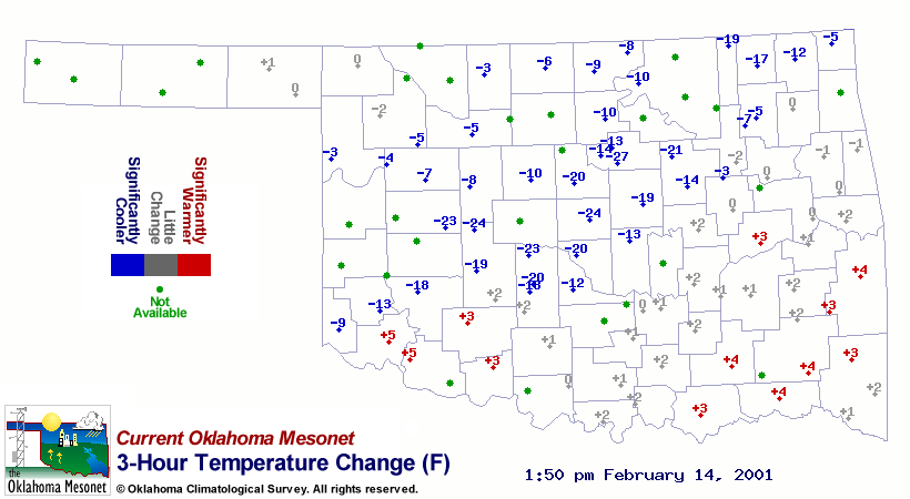
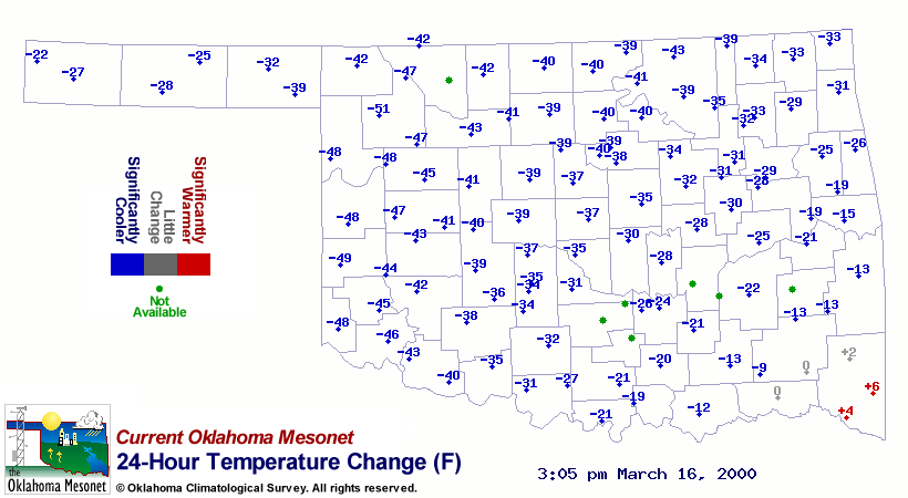
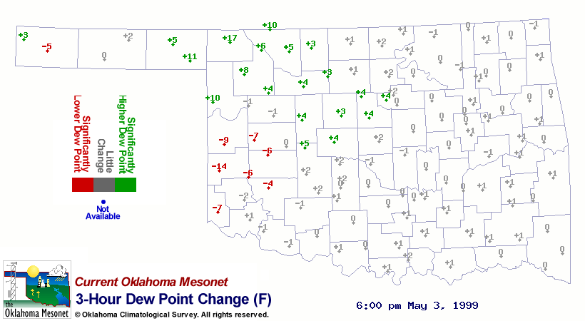
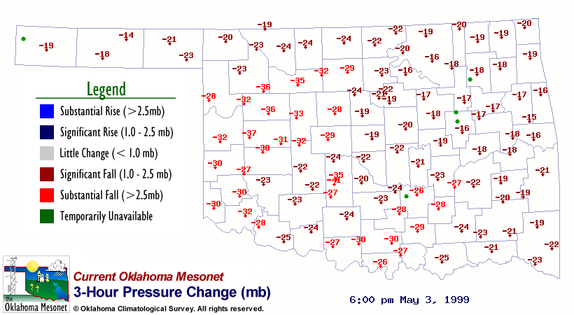
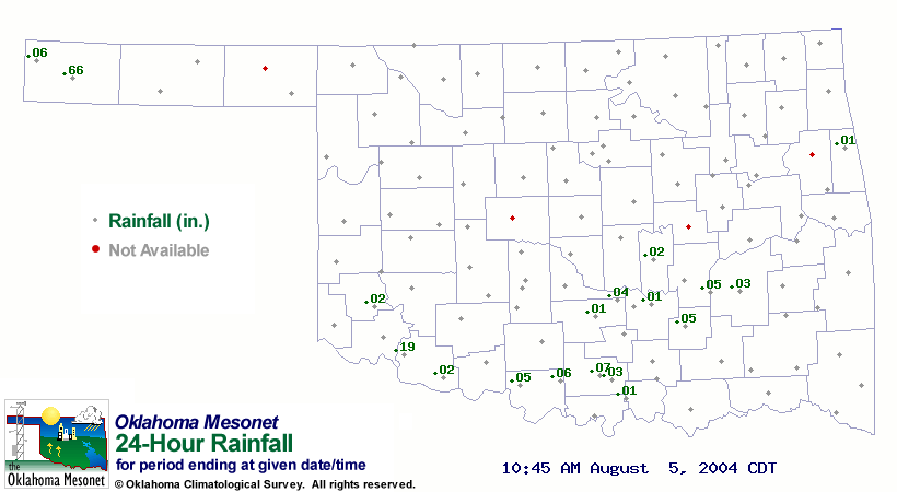
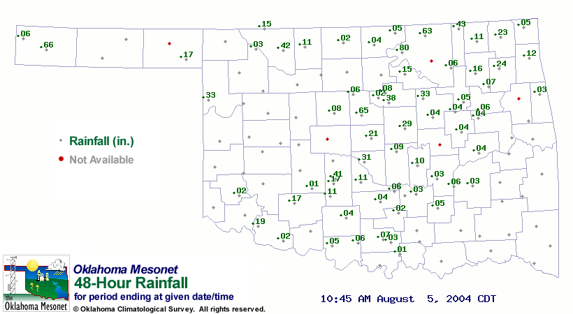
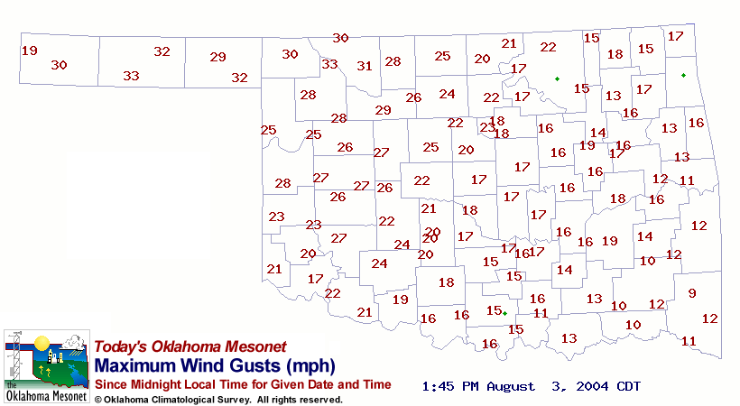
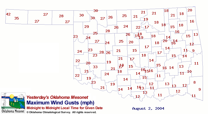
The images on this page are not from the same date. Archived images have been selected to help the user better understand how to use each of the products.

You may find the Mesonet Interpretation Page useful for properly interpreting Mesonet data.


Examples of Weather Phenomena Found In Mesonet Data

 
Maps
Basic Weather Maps
Latest Weather Map Fire Weather Map
Exposure Maps
Heat Index Map Wind Chill Map
Soil Temperature
Bare Soil Temperature Map (2 in.) Sod Soil Temperature Map (2 in.)
Mesonet Weather Trends
3 Hour Air Temperature Change 24-Hour Temperature Change
3 Hour Dewpoint Temperature Change 3 Hour Air Pressure Change
Rainfall Maps
24 Hour Cumulative Rainfall Map Yesterday's Rainfall Totals
48 Hour Cumulative Rainfall Map 72 Hour Cumulative Rainfall Map
Mesonet Winds
Latest Wind Speeds and Gusts Maximum Wind Gusts Since Midnight
Severe/Sustained Winds and Gusts Query Yesterday's Maximum Wind Gusts
Cold Front with Freezing Line from November 10, 1995
Air Temperature Rainfall
Wind
Dryline
June 18, 1998 May 19, 2004
Solar Radiation
June 18, 1998 February 22, 2001
Mesonet Statistics
Mesonet Monthly Summaries
Graphs and Meteograms
Meteograms Highlighted in the Mesonet Ticker
August 24, 1999 (Thunderstorms) August 26, 1999 (Turbulent Heating)
September 9, 1999 (Nighttime Cooling)
March 16, 2000 (Freezing Event) Jaunary 16, 2001 (Wet-Bulb)


OK-FIRST Project Oklahoma Climatological Survey, 100 East Boyd Street, Suite 1210, Norman, OK 73019.
Copyright © 1996-2005 Board of Regents of the University of Oklahoma.
All Rights Reserved.
Send comments or questions concerning OK-FIRST to okfirst@mesonet.org