![]()
|
of January 3-5, 2005 Answer to Question 7 |
|
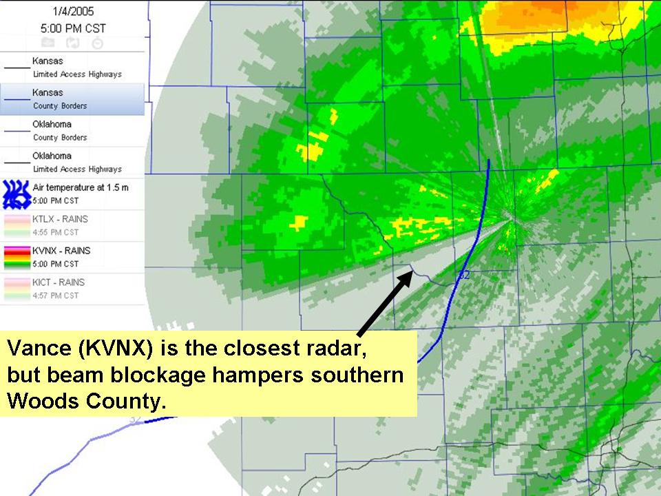
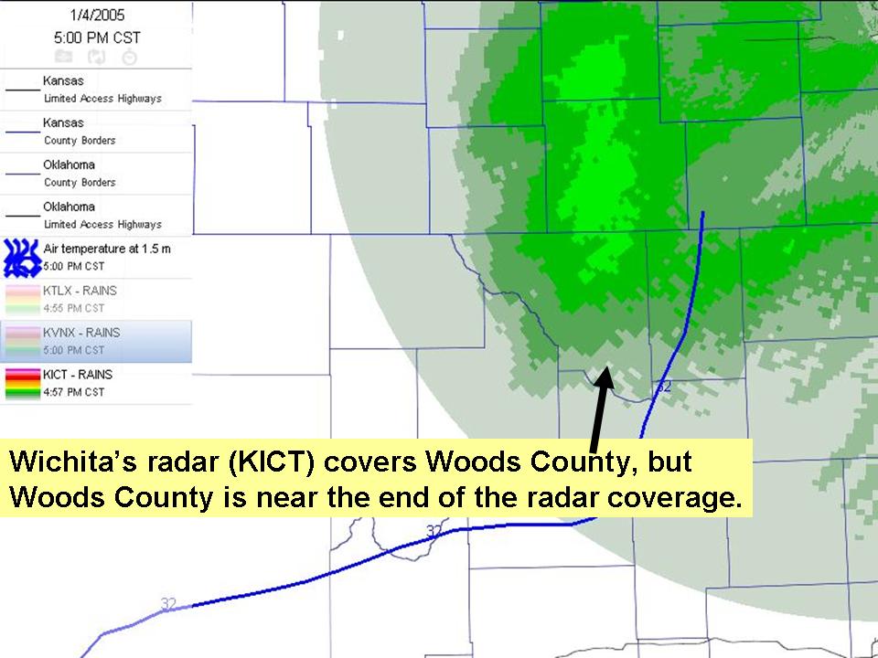
7. Examine the 5:00pm storm-total rainfall estimates for the Vance-KVNX, Wichita-KICT, and Norman-KOUN radars.
- About how much precipitation has fallen north of the freezing line?
- Focus on Eastern Woods County. Do the three radar estimates agree on storm-total precipitation here? What may be some causes of disagreement?
- Focus on Southeastern Woods County. Do the three radar estimates agree on storm-total precipitation here? What may be some causes of disagreement?

Answer.
- The Vance AFB radar indicates precip accumulations of 1.5-2.0 inches across the now sub-freezing portions of northwest Oklahoma. The Wichita radar indicates up to 1.5 inches across much of this region, too. The Norman radar's estimates are much lower.
- The differences between radar totals may be due to several possible factors:
- The precip-accumulation algorithms began at different times at each radar: 0442 UTC at Vance; 0641 UTC at Wichita; 1324 UTC at Norman.
- The three radars are sampling the atmosphere from three different distances. Thus, for any given point, each beam has a unique heights and a unique beamwidth. These will affect reflectivity measurements and subsequent calculations.
- "Bright band" contamination may be occuring near the freezing level.
- In southeast Woods County, the Vance radar is grossly underestimating reflectivity and precipitation due to beam-blockage immediately west-southwest of the radar
The Bottom Line:
-
Radar can provide tremendous detail about the location and relative intensity of precipitation, but its accuracy is hampered by a number of limitations.
OK-FIRST Project, Oklahoma Climatological Survey, 100 East Boyd, Suite 1210, Norman, OK 73019
Copyright © 1996-2005 Oklahoma Climatological Survey. All Rights Reserved.
Send comments or questions concerning OK-FIRST to okfirst@mesonet.org.