![]()
|
of Winter 2005-06 Answer to Question 4 |
|
4. You check the 8:00 am products from the Oklahoma Fire Danger Model. To be honest, the fire danger looks pretty minimal right now in your part of the state.
- What weather factors are causing the pockets of high fire danger in the east and the panhandle?
- Do you think you are out of the woods for the day? Why or why not?
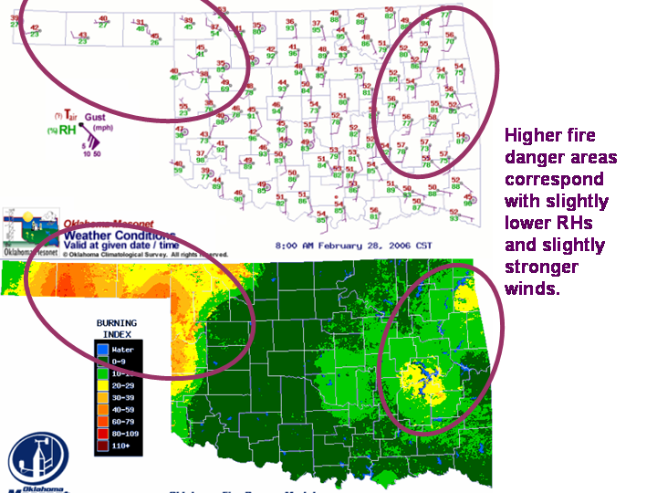
Answer.
- The higher fire danger values in eastern and far western Oklahoma correspond to lower relative humidities and stronger winds in those parts of the state.
- You are not out of fire danger for the rest of the day. In the higher fire danger areas, the RH and wind fields are still less severe than they are forecast to be in Stephens County this afternoon.
The Bottom Line:
- The Oklahoma Fire Danger Model is a diagnostic tool. It only worries about the "right now", and doesn't incorporate forecasts (yet :) ).
OK-FIRST Project, Oklahoma Climatological Survey, 100 East Boyd, Suite 1210, Norman, OK 73019
Copyright © 1996-2005 Oklahoma Climatological Survey. All Rights Reserved.
Send comments or questions concerning OK-FIRST to okfirst@mesonet.org.