![]()
|
of Winter 2005-06 Answer to Question 7 |
|
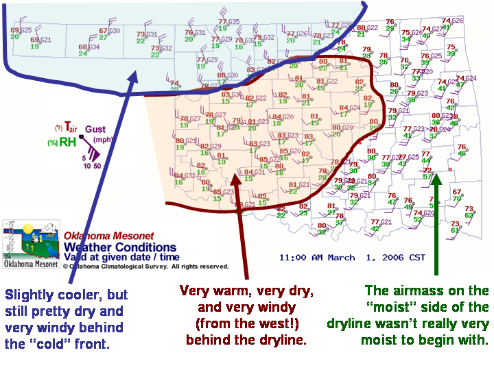
7. It's now 11:00 am on March 1st.
- What are the chances of a firebrand starting a reportable fire for most of Stephens County?
- If a wildfire were to occur, about how tall would the flame at the head be?
- If a wildfire were to occur, about how fast would it move?
- If a wildfire were to occur, what direction would it move?
- Can you see any wind shifts indicated in the Mesonet datasets?

Answer.
- The central part of Stephens County, a firebrand would have a 50-62% chance of starting a fire at 11:00 am, up slightly from yesterday (table shows KETC Mesonet site at 56%).
- The BI category indicates flame lengths of approximately 8-11 feet, like 3pm the previous day (KETC: 95 BI = 9.5 ft).
- The SC category indicates forward speeds of about 40-80 feet per minute (KETC: 83 SC = 83 ft/min).
- As of 11:00 am, you'd expect any wildfires to move eastward. However, there is a gradual turning of winds in the region, and winds are almost due northerly behind the cold front.
The Bottom Line:
-
There was no real mention of westerly winds or a dry in (in the discussions we read, anyway -- the Norman forecast discussion did mention winds turning to the southwest during the day). Another reminder to pay attention to multiple products and don't take forecasts for granted!
OK-FIRST Project, Oklahoma Climatological Survey, 100 East Boyd, Suite 1210, Norman, OK 73019
Copyright © 1996-2005 Oklahoma Climatological Survey. All Rights Reserved.
Send comments or questions concerning OK-FIRST to okfirst@mesonet.org.