![]()
|
of January 3-5, 2005 Answer to Question 6 |
|
6. Examine a movie from 4:00 am to noon on Tuesday Jan 4th, with BREF1 from Vance AFB (KVNX), Mesonet air temperatures and Mesonet wind observations.
- What precip type is suggested by the radar echoes?
- Where is the freezing line, in relation to the precip observed by the Vance radar?
- What is happening to the Mesonet's wind observations north and west of the freezing line? Why is this?
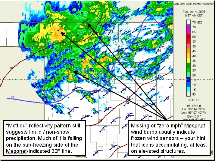
Answer.
- The reflectivity patterns still show the mottled, cellular characteristics of liquid preipitation
- Much of the precipitation is falling to the north/cold side of the Mesonet-indicated 32F freezing line (in blue).
- In much of this sub-freezing precipitation area, the Mesonet wind barbs are missing. They have been reduced to zero by ice accumulation.
The Bottom Line:
- Mesonet wind observations are often your first clue (other than spotter reports) of ice accumulations on elevated structures.
- They are 10 meters (33 feet) off the ground
OK-FIRST Project, Oklahoma Climatological Survey, 100 East Boyd, Suite 1210, Norman, OK 73019
Copyright © 1996-2005 Oklahoma Climatological Survey. All Rights Reserved.
Send comments or questions concerning OK-FIRST to okfirst@mesonet.org.