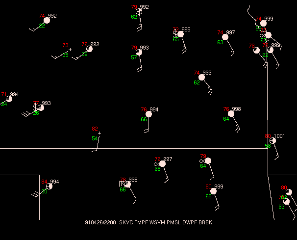
1. At 4:00 p.m., find the dry line.
Answer |
2. At 4:00 p.m., what areas can be ruled out for severe weather to occur?
Answer |
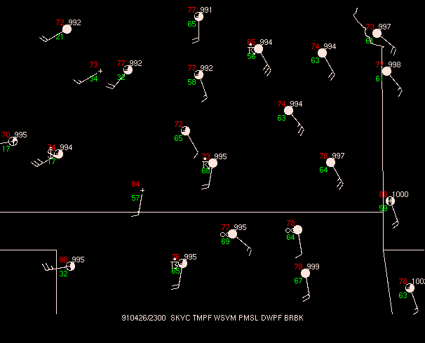
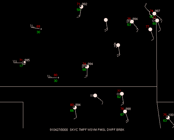
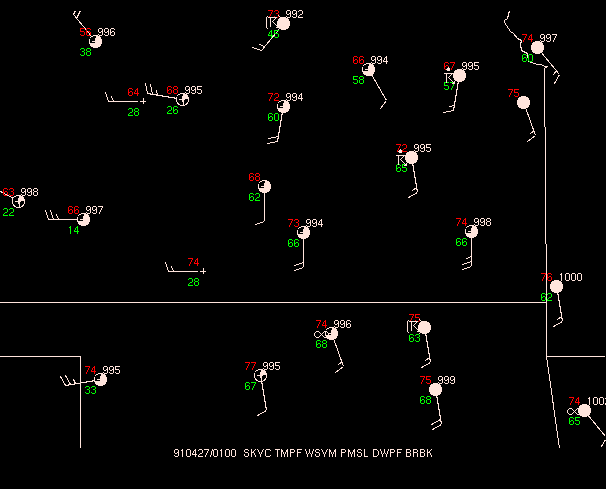
3. What happens to the dryline between 4:00 p.m. and 8:00 p.m. in Kansas? in Oklahoma? Can the dryline be found looking at information other than surface maps? (Hint: You might focus on available products at 7:30 p.m.)
| Surface Maps |
|
|
Radar Images from Oklahoma City (KOKC) at
7:30 p.m. |
|
|
Answer |
4. At 6:28 p.m., identify the prominent features in Garfield and Noble counties on the Tilt 1 Base reflectivity scan.
Answer |
5. Also at 6:28 p.m., examine the reflectivity scans on Tilt 2 and Tilt 3. What feature on Tilt 3 seems to be correlated with the storm as seen on Tilt 1?
Answer |
6. What pattern in the Base Velocity scan at 6:28 p.m. is correlated with the feature seen in Question 4?
Answer |
7. Examine the VIL product at 6:34 p.m. Where is the largest hail? Where is this relative to the reflectivity and velocity patterns observed during the same volume scan?
Answer |
