![]()
|
|
|
|
| |||||
|
|
1. Describe the weather conditions across Oklahoma
at noon on November 10, 1995. |
|
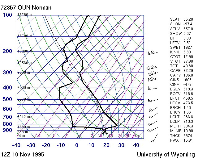
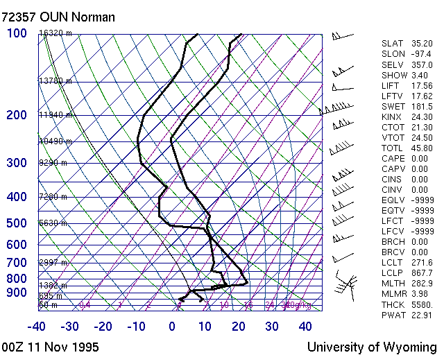
2. Look at the Norman soundings at 6:00 a.m. and 6:00 p.m. What happens at the surface between 6:00 a.m. and 6:00 p.m.? OUN 6 AM OUN 6 PM Answer |
|
3. Look at the radar base reflectivity images between 3:45 (2145 UTC)
and 4:30 p.m (2230 UTC). Classify the echoes as convective, stratiform, and non-precipitating. Radar Loop Answer |
|
4. Match the echoes described in question 3 to Mesonet temperature,
dew point, and solar radiation plots at 4:30 p.m. |
|
5. Examine the reflectivity feature that moves from Grady, McClain, and
Cleveland counties at 4:00 p.m. to Pontotoc and Murray counties at 5:30 p.m.
What happens to this feature? Does it strengthen, weaken, dissipate, or does something else happen
to it? |
|
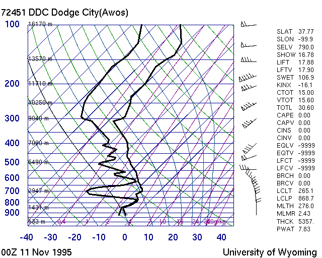
6. Look at the radar echoes between 6:00 and 6:30 p.m., the Dodge City sounding
at 6:00 p.m., and Mesonet data between 6:00 and 6:30 p.m. What type of precipitation
do you think is falling in the following groups of counties: Is there a difference in the appearence and texture of the radar echoes in these groups of counties? Radar Images 6:00 p.m. 6:07 p.m. 6:13 p.m. 6:19 p.m. 6:24 p.m. 6:30 p.m. Dodge City Soundings 6 PM Mesonet Data 6:00 - 6:30 p.m. Answer |
|
7. Look at the radar echoes at 9:30 p.m. (0332 UTC) What type of precipitation is falling
in the Oklahoma City and Tulsa areas? Compare the precipitation that is likely falling in
Lincoln county with the precipitation that is falling in Pittsburg and Atoka counties.
|
|
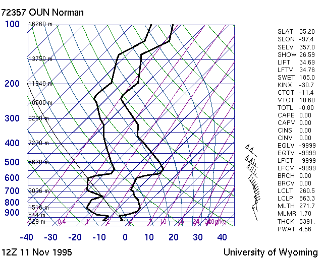
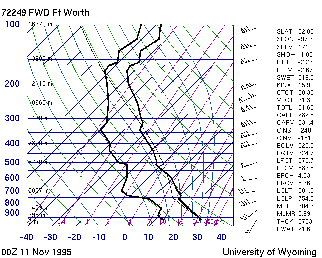
8. What happens to the Norman sounding between 6:00 p.m. on November 10, and 6:00 a.m.
on November 11? What about Fort Worth? |
|
9. Look at the Mesonet temperature plots between 3:00 p.m. and 10:45 p.m.
Describe a change in shape of the isotherms. What do you think might be responsible for this
change? Hint: Looking at a particular isotherm, like 32°F, might be helpful.
|
|
Additional Mesonet Loops |
|
OK-FIRST Project,
Oklahoma Climatological Survey,
100 East Boyd Street, Suite 1210,
Norman, OK 73019.
Copyright © 1996-2005 Oklahoma Climatological Survey. All Rights Reserved. Send comments or questions concerning OK-FIRST to okfirst@mesonet.org |